Open competition
Existing
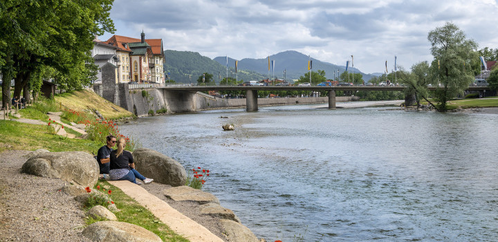
The Roter Main is central to the site. It has influenced and continues to influence both the physical and human aspects of the site. The river runs through various landscape typologies along its course, namely arable farmland, woodland and urban. At the point where the river runs through our site it intersects a basin of farmland, surrounded to the north, west and south by the city of Bayreuth. To the east lies similar farmland before reaching the Schloß Eremitage. The banks of the river are lined with riparian woodland, protected by biotope status. In this sense the site acts as a connective space between the urban, rural and cultural landscapes across the city of Bayreuth.
The drift and fluvial geology of the site has also been closely considered. Again the river plays the central role in influencing this. The topography of the site varies from wide, low lying floodplain to steep valley sides at the sites periphery. The floodplain is characterised by a waterlogged soil which has accumulated clay deposits over many years of flooding. The valley sides are better drained with a loamy soil. This then defines the landscape typologies which can exist, depending on their microclimatic preferences such as wet or dry, clay or loam, steep of flat. Simply put, there exists a ring of well drained soil and its associated ecologies, surrounding a heart of wetter soils and its associated water tolerant ecologies.
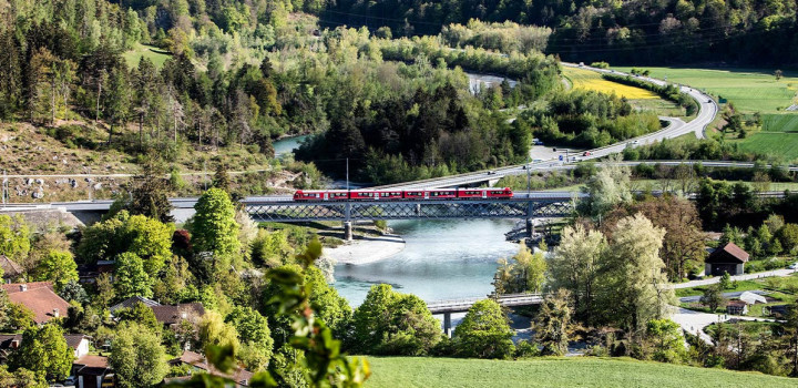
In the cultural context of Bayreuth the legacy of park design which Wilhemina has left also plays a part in influencing the site. It sits between the old town, Hofgarten and the Eremitage. They are connected by a series of local and regional cycle routes. The main routes extend beyond Bayreuth to other towns and villages, and to other similar cultural landscapes influenced by Wilhelmina such as the Festspielhaus, Schloß Fantasie and further afield Sanspareil. An important route that connects these points is Ellrodtweg, with runs along the course of the river into the site. It is important then to consider the site as a key link in the chain of important spaces that are strung along the river.
Proposed
The name ‘Park am Roter Main’ is proposed to encompass all the aspects of the concept. The three main themes that form the identity of the park are the formation of a responsive circulation network, the response to microclimate, and the referencing of ideas used in Wilhelmina’s landscape designs. These ideas form the basis for a park which has both human use and nature in balance and aims to develop interactions between the two. The Auerpark and Generation park are formed together by this approach.
Circulation
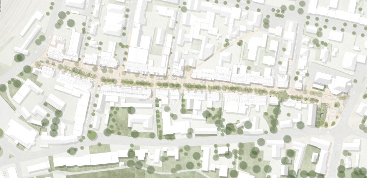
A new ‘Loop’ is proposed as the backbone of the site. 6 meters wide, the cycle and foot route connects all the entrances with the river and continues the regional cycle routes through the site. The structure of the entire park is closely integrated into this loop. The route allows visitors to experience a cross-section of different topographies, ecologies and spaces important to the park. It also provides vehicle access for the garden show, events, and maintenance. The entry points it connects are from Äußere Badstraße, Eremitagestraße, Ellrodtweg, Albrecht-Dürerstraße and Obere Röth.
A secondary hierarchy forms smaller loops within the large loop. These 3m wide paths allow for continous circulation within the park. Each loop varies in length and allows either shorter or longer journies. 1.5m wide gravel paths continue the path style into less formal areas of the site, connecting the larger loops.
Microclimate
Surrounding the main circulation loop runs a prominent band of tree plantings called the ‘Woodland Ring’. The woodland ring contains a matrix of different landscapes that are interconnected through a response to the various on site microclimates. At the basic level this deciduous woodland can be separated into 2 types - Riparian Woodland dominated by Alnus, Fraxinus, Salix and Poplus, that exists when the ring crosses the floodplain, and Fagus dominant woodland that exists on the higher and drier surrounding slopes. Within the woodland lies a series of wet and dry gardens. Again their typology depends on their location, wether they lie on the floodplain or the slopes and respond to moisture and light conditions. Their setting within the woodland helps to provide shelter from winds and frost. The ring as a whole also helps to protect the internal site from harsh winds, creating a more tolerable environment for visitors.
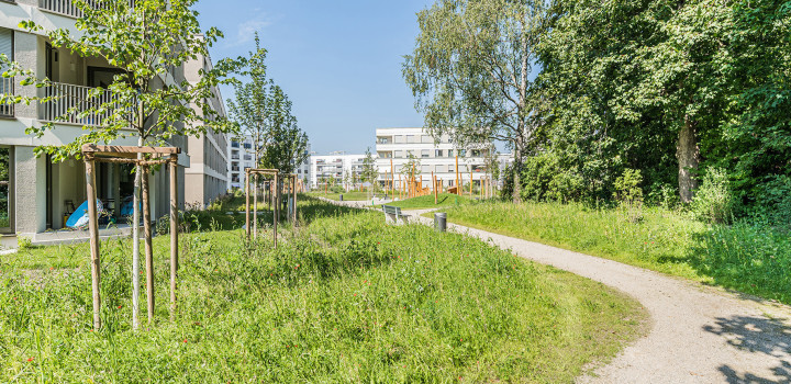
In contrast to the densely planted woodland, the internal areas of the park consist mainly of a series of open meadows. These include the Lower and Upper Meadows, Amphitheater Lawn and Exhibition Lawn, as well as water meadows and wetlands. The Lower Meadows and Lawns lie in the floodplain and are designed to flood if necessary. The species composition here is more moisture tolerant and less diverse, suited better for more intense cultural and sport use. The Upper Meadows consist of long grass and a more diverse range of wild flowers and herbs, better suited to drier soils.
Within the worst drained parts of the park lie the wetlands. These areas flood regularly with the fluctuations in the water table. The wetland structure has extended what were originally streams and drainage channels to form contiguous aquatic habitats. To the east of the Roter Main the wetland also helps to provided a fish spawning ground that is connected to the new salmon ladder.
Wilhelmina
An intentional relationship has been created between the design of the park and that of the Eremitage. The design attempts to consolidate the two sites and form a narrative that reinterprets the historic 19th century style. At the same time the design remains fully contemporary and integrates the latest ideas of environmental sustainability. The theme picked from the Eremitage has been the idea of the ‘Hidden Garden’. This is a prominent part of the experience within the Eremitage and has been considered an integral aspect of Park am Roter Main. The hidden gardens in the Eremitage lie within a contiguous block of woodland mainly to the north of the Schloß. They each contain their own experience that is well isolated from the external world. Each space has an intimate scale and a sense of surrealism.
This idea has been taken into the new park. Within the woodland ring lies a string of hidden gardens. They naturally attempt to capture the atmosphere of romanticism and intimacy that is created in the historic garden, whilst allowing the geology of the site to define the themes of the gardens. The main factor in the type of garden found in each space along the woodland ring is the moisture content of the soil. This defines wether it is a wet or dry garden and ultimately the species composition, scale and texture. Combined with this, is the relationship the garden has with its topographic gradient and light exposure. These factors combine to produce a series of diverse gardens that have their roots both in a historic narrative and a sustainable, analytical process.
Park Typologies
There are two main differences between the ‘Auerpark’ and the ‘Generation Park’ - Connectivity and Ecology. The Auerpark relates to the river and its surrounding hydrology, and has a linear grain north west- south east. The Generation Park, either side of the river focuses more on connecting to the sites peripheries and integrating the site with the local context, its neighbourhoods.
In terms of ecology the Auerpark focuses on a separation between human use and nature. Whilst there are numerous board walks intersecting the different aquatic habitats, there is no direct contact. The focus here is on the experience of ‘wild’ nature. For the Generation Park, whilst there are many habits within it that are of ecological value, the focus here is on human use and interaction with these natures. At the centre of the Generation Park is the Auersee. This is an artificial basin normally filled with water, that can
be used as a large informal swimming lake. The basin can also be drained and used for large temporary events such as music concerts which, depending on their capacity can use the overlooking Amphitheatre Lawn as well. The aim is to offer an alternative to the Festplatz to the west of the site.
Architecture
All buildings, permanent and temporary, follow the same principles. Single story and timber clad. The most important building is located at the main entrance from Äußere Badstraße. This contains a large restaurant and cafe, toilets, information and a viewing tower from which the majority of the site can be appreciated. The tower allows the visitors to see over the obstructing dam and begin to understand the site as a whole. It also acts as a landmark that can be seen from the surroundings marking the location of the park.
There is a pavilion located beside the Äuersee. A bar and kiosk for the summer months, it also has capacity for storage in connection to large events that take place in the basin, and includes toilets. Located within the wetland to the south is the Ecological Education Centre. This small Pavilion offers a learning platform to school groups and members of the public that would like to learn more about the ecology of the park and the surrounding areas of Bayreuth. The structure will be raised as to avoid large floods. There is a maintenance depot with a building for the machines and equipment necessary to maintain the site. The total area is 800m2. It is located at the entrance to Eremitagestraße for easy access into and out of the site for large vehicles.
Horticultural Show
The horticultural show is focused on three elements. The Garden Show Plots, located within the lower meadows, the Exhibition Area, which includes the lawn and Exhibition Halls and finally the flower beds for the entrance areas.
There will also be temporary kiosks at every entrance that house toilets and informations boards about the garden show. A temporary restaurant and bar will be located near the Albrecht-Dürerstraße entrance. It will remain in place for the duration of the Garden Show, before being removed.
The location of the Garden Plots for the show are split into 2 groups and placed on the flattest ground in the park. The form mirrors the form of the permanent aquatic gardens that wrap around the Äuersee. Within the plots are areas of gravel with movable seating, allowing visitors to relax in the heart of the show and make their own seating arrangements.
State Garden Show
Open competition for open space planning with realization and idea part
Client
- Stadt Bayreuth, Stadtplanungsamt
Project Data
- Planning: 2011
Year
2011
Location
Bayreuth